Recently, while visiting Puerto Rico and preparing to move (May 2021), my husband and I took two days off and set out to photograph the north and northwestern beaches of Puerto Rico. The weather was hot, so what better way to stay cool than to get out onto some breezy beaches, where we could enjoy the waves and the sun. We were definitely photographing for a purpose: Our 2022 Puerto Rico calendar.
We left San Juan about 7:30 am, driving along the north coast. Our first stop was “Los Tubos”. The naming of beaches in Puerto Rico poses certain challenges for a writer. Some have Spanish names, and some English names. Even Google tries to translate them, but the translations don’t always coincide with local usage. Some use the word “playa” in the name, some use the word “beach”. I supposed there is a rhyme and reason to all this. For my part, I am going to give you the local usage name. (That means if you’re visiting and have to ask for directions, that is the name you should use. Google may show the name in the other language, so be aware that it might be a translation.)
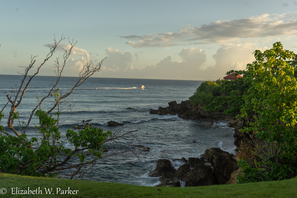
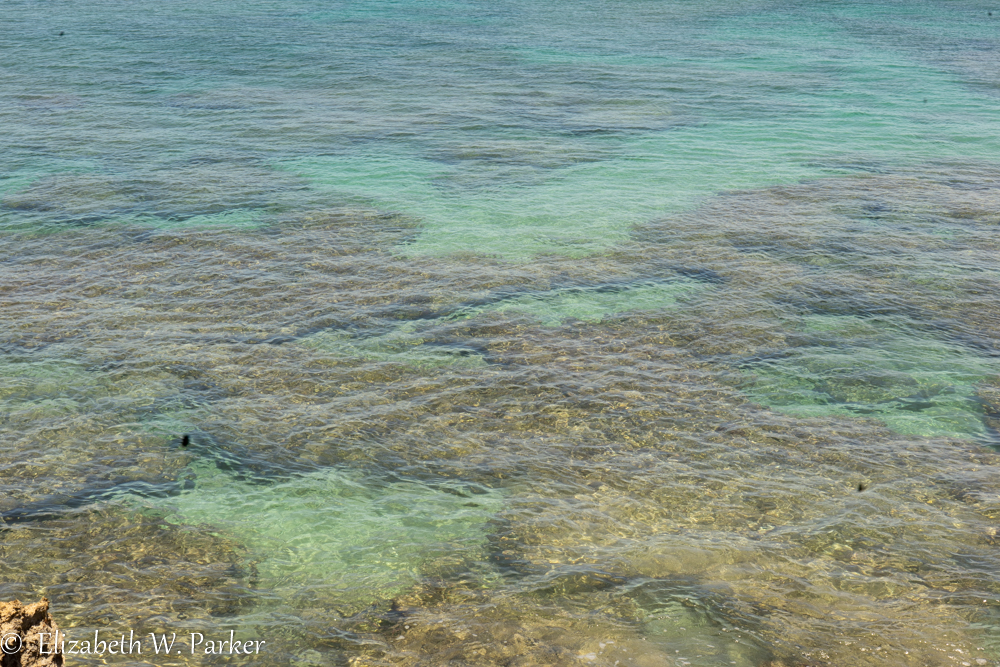
Los Tubos Beach, near Manatí, is a beautiful stretch of open beach on the Atlantic coast. As near as I could ascertain, Los Tubos refers to the “tubes” that form as big waves break, as in surfing. I didn’t know the north coast as a place for surfing, but I was surprised to learn that there are potentially good waves all year here because the beach is so wide and open. Right in the same area, moving westward is Playa Pata Pata. Pata pata in English means paw paw, a tree with a fruit of the same name. Though it is native to Puerto Rico, this is the first reference I have found for it. And, just beyond Pata Pata is the famous Mar Chiquita, a hemispherical sandy beach around a pool of calm water made by a break in the rocks that line the shore. On a Thursday morning, early summer, all three of the beaches were nearly deserted. Mar Chiquita is very popular with families because the water is safe for children. The rocks offer decent snorkeling.


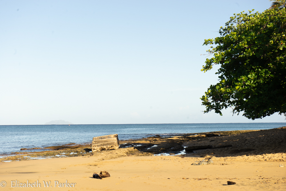
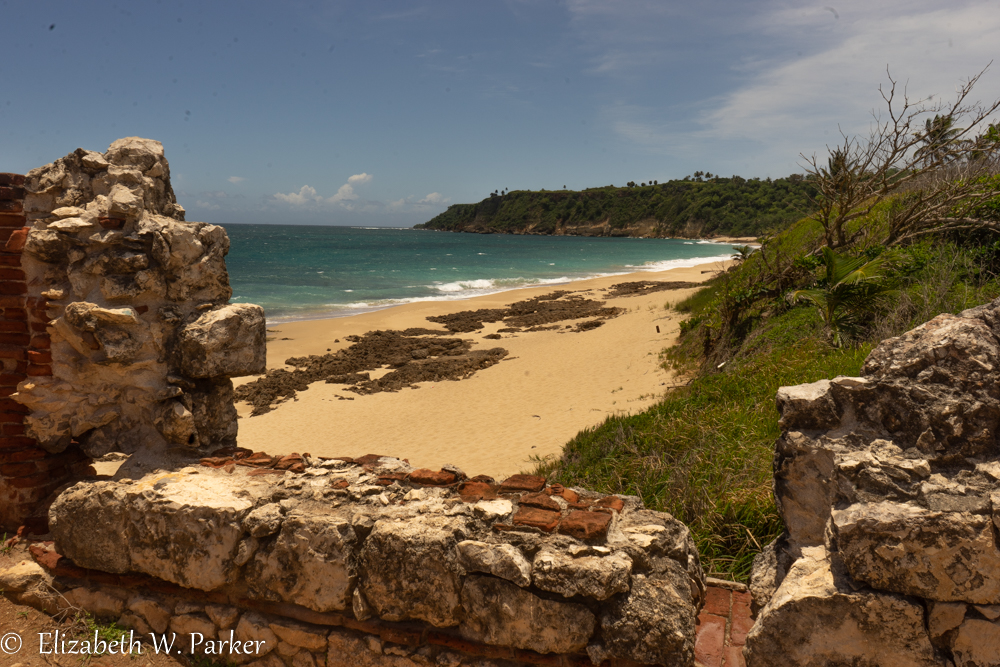
After this trio, (and by no means are these the only beaches near Manatí!) we drove over to the area near Arecibo. We stopped to see the statue of Christopher Columbus. It is easy to see from the road, and that was our only choice as the access to it was closed. Despite its checkered history, (see the article above) the monument is impressive. It is huge. (I found out it is even taller tha the Statue of Liberty, making it the tallest statue in this hemisphere.) It is erected at the top of a hill, so it is visible for quite some distance, if you are far enough away (as in: out on the water). You will see in the picture that follows that we could see it from the beach. As a piece of art, there isn’t much to say, though I found charming the little ship that is sailing round the base. The name of the statue is “Birth of the New World,” and so as a symbol it is controversial, a reminder of history both good and bad. Puerto Rico’s history is tied to that of Spain, and Columbus did stop in Puerto Rico in 1493. Without getting political, I would say it is a good teaching and discussion opportunity for all age people.
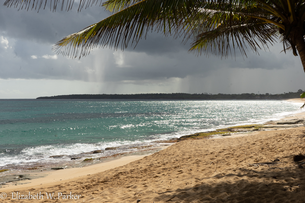
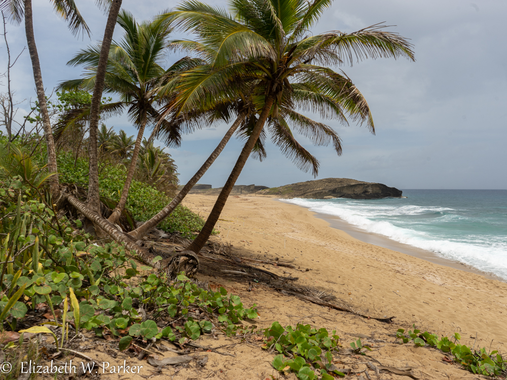
The sky was clouding up for the early afternoon “daytime heating” shower, so we decided to forego the Cueva del Indio (which has an entrance fee), and went in search of access to the beach nearby. We pulled off the road and climbed a steep dune and found the access we wanted. On the other side of the dune, another wide deserted beach greeted us, with some spectacular rock escarpments to the west. The beach has no name on the map, but we did find references to it as the Playa los Hippies. On Google it shows up as Arecibo Oceanfront Paradise, or maybe Playita Inez but there is no signage using any moniker.


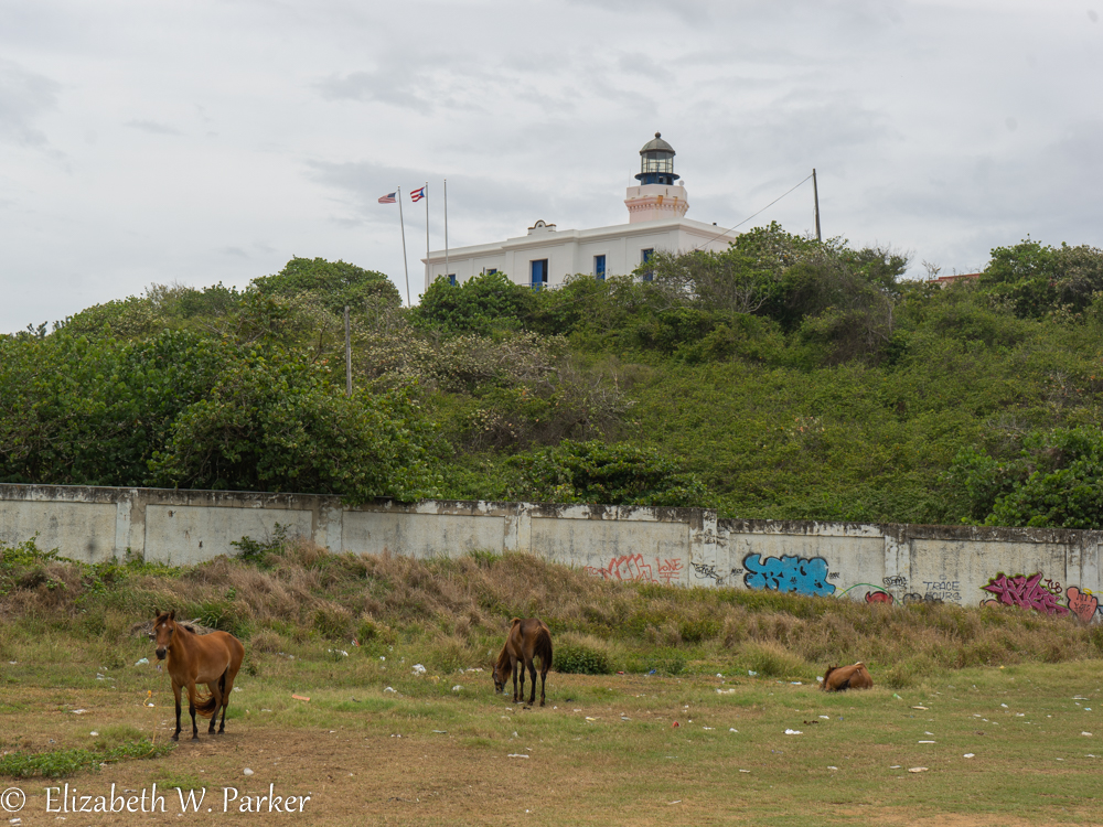
We did stop briefly at La Pozo del Obispo, a beach right at the base of the Arecibo Lighthouse, but we didn’t stay. Skies were grey, the place was crowded and we were hungry. We have also photographed it before, and I am chagrined to say that I know I have mislabeled it in the past. Like Mar Chiquita, it is a large pool created by waves that splash against the rock barrier and overflow into the pool in beautiful concentric rings. It is spectacular, and well worth a visit. I did take this picture of horses grazing below the lighthouse. The wall of murals is quite dilapidated. I suspect that was the work of Hurricane Maria, because I remember a long line of murals from my earlier visit.
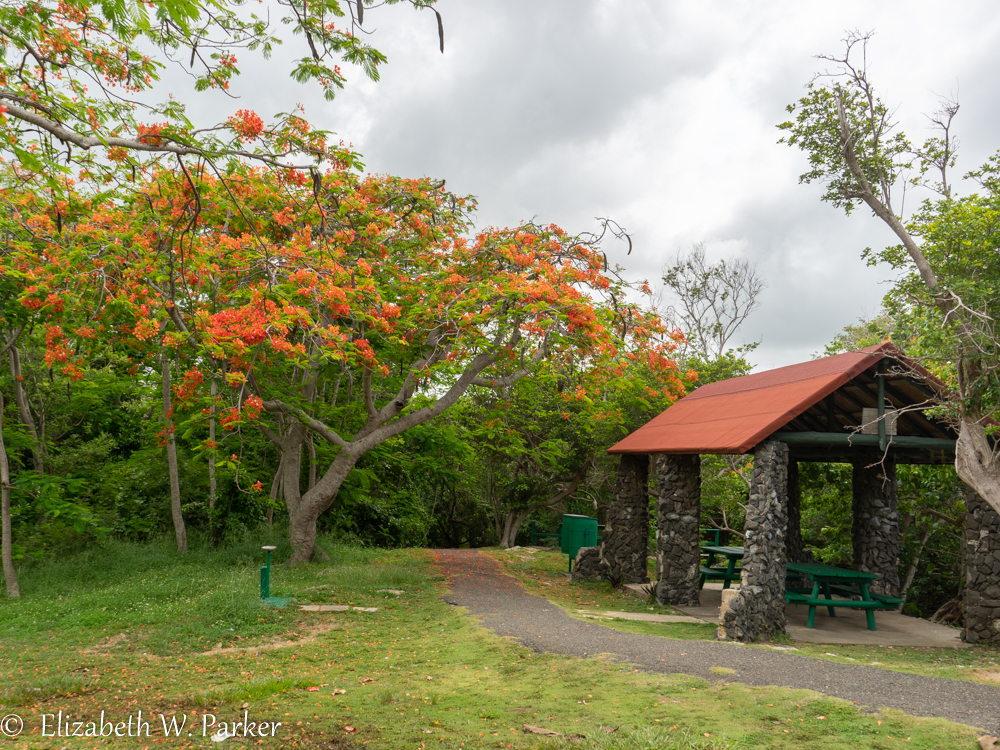
After lunch, we made a couple of tourist-stops. We found a a flamboyán (royal poinsiana tree), which is a calendar staple; then went on to see el Tunel de Guajataca. Here there is a park built around a train tunnel that was chiseled from the rocks along the shore in the late 1800s for a steam train. It is scenic, but a place I had photographed before. We also made a little detour to snap the Cara del Indio.


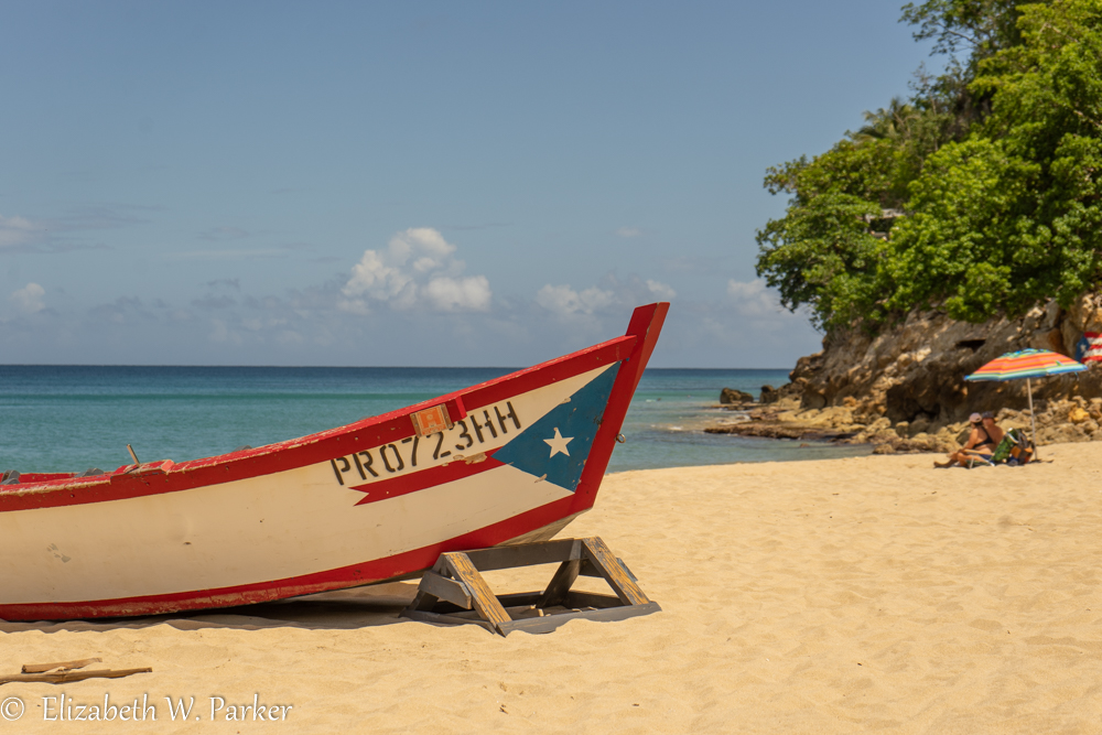
Finally, we arrived at Crash Boat Beach. It was packed to the gills. The traffic was a mess trying to get into the parking. The sky was threatening, too, but I hopped out of the car to see if there were any photos better than the one we already had from a visit years ago. I took a few shots, but the music was deafening, and the people swarming around without masks was unnerving, so we placed it on the list for the following day (to go early enough to beat the crowds.)

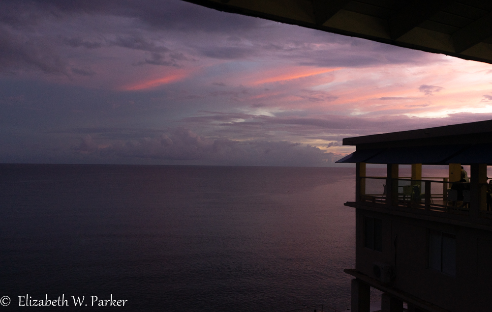
We stayed in a cute little place in Rincon called the Coconut Palms Inn. It was nothing to write home about, but comfortable enough for one night, and right on the beach. Sunset shooting would have been perfect there but by evening it was overcast and raining. We had dinner at a place called Pa’ la 22 and got a beautiful pink and purple sunset with our dinner (served on a covered but open terrace and set up for social distancing).
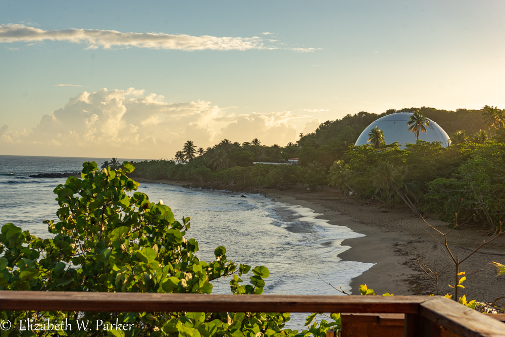
First thing the next morning, we were out at el Faro de Rincón (the lighthouse). It is beautifully maintained, as is the park around it. It is a lovely place to see the sun come up, in a place where usually people visit to see it go down! To the immediate north of the park is Domes Beach, crowned by the remains of a nuclear reactor dome from the 1960s.

From Domes, we moved slightly north to visit another beautiful beach called Sandy Beach West. Imagine, it was still well before breakfast but there were already a couple (literally two) sunbathers on the beach and three surfers showed up just as we were ready to leave. (Yes, there is a Sandy Beach East, too, but we didn’t visit on this trip.)
From there, we headed south again in the direction of Rincón, and stopped at Steps Beach. I remember these beaches from my very first trip to Puerto Rico back in about 1981. I am sure I have been another time – thinking maybe when my children were young, i.e. the 1990s, for snorkeling (me) and diving (my husband and sons). Steps is named for (you guessed it!) actual steps… pictured here. They didn’t always sit on the beach like this. I have a memory of there having been a wall and these the steps on the waterside of it. Could be a found memory though – product of ample imagination.
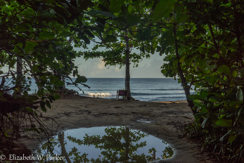
As we were headed back to the car, we stopped to talk to a woman coming onto the beach. She wanted to show us her “special place.” And, yes, it was pretty special: Under the branches of huge trees that leaned out over the beach and rocks, she had found a shady “room” with a beautiful view and access to the water. A wonderful place to sit on the beach, secluded and quiet.
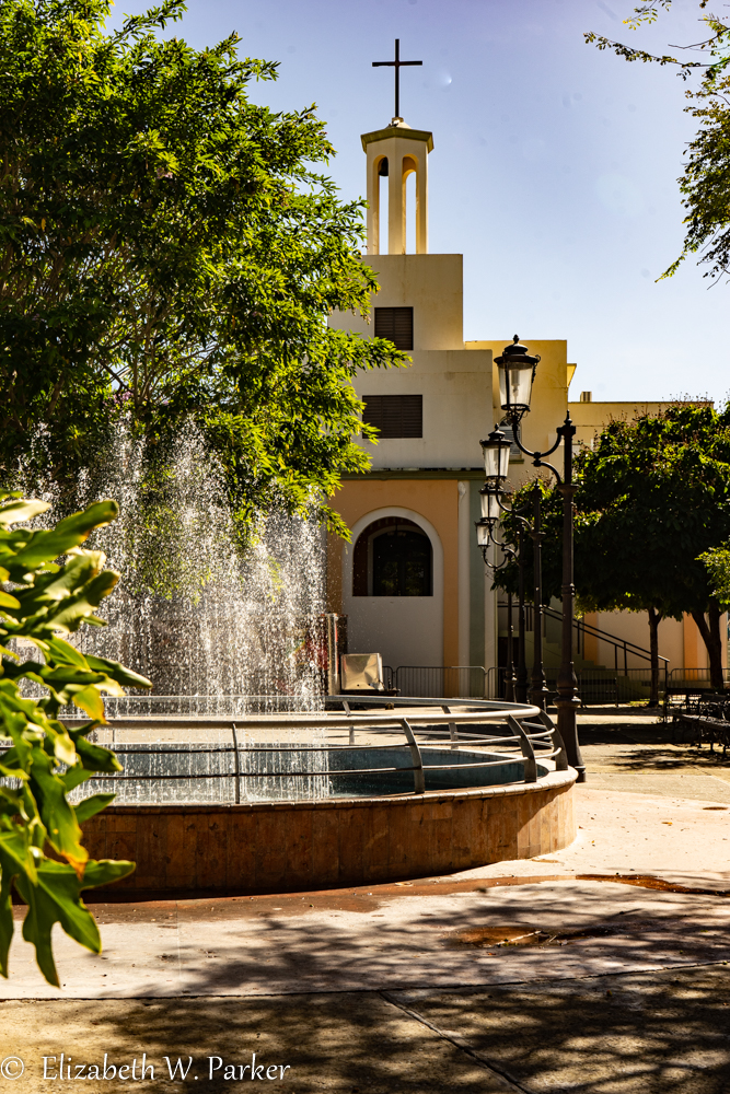
Hungry, and close to the town of Rincón, we went to a café near the cathedral for coffee and breakfast. That gave us the proximity to shoot the cathedral and the plaza without a lot of people, but there were cars and barricades (for what we didn’t know), so it was a challenge to get even a half decent shot.


We returned to our hotel and gathered up our things. Checked out we headed back northward towards Aguadilla, intent on getting to Crash Boat in what we thought was early in the day. Wrong! The place was thronged, yet again, and it was barely 9:45 am. No parking, so Gerry drove around and I jumped out and tried to find a shot. I took some shots, but perhaps I didn’t get any…
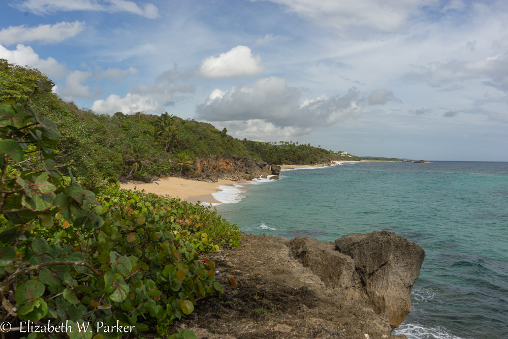
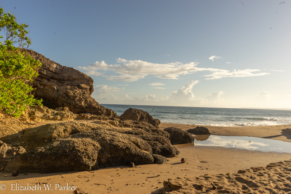
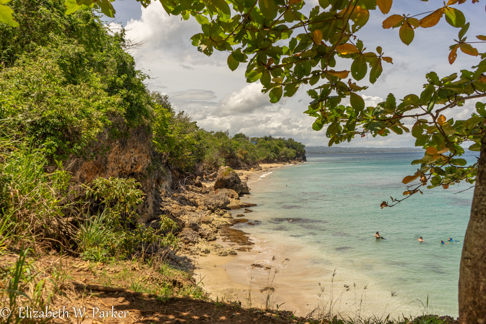
With a certain “sense of adventure” we set out to try to find Wilderness Beach. We didn’t, and we didn’t get much help or direction from the people we asked, but we did see what I thought we the most beautiful beaches of the entire trip. These were Peña Blanca and Punta Borinquen. They both had the requisite wide sandy shores with picturesque rocks, incredible blue skies and lush tropical vegetation. But they also had crystalline turquoise- emerald water that reminded me of beaches in Sardinia.
Peña Blanca is a beautiful beach for swimming – in the summer. During the winter months, it is a surfing beach. That is true, from what I am told, about most of the beaches on the west coast. We were there in early June and the water looked fine for swimming and the beach safe enough (from big waves) for small children. The water was so inviting – the color just gorgeous.
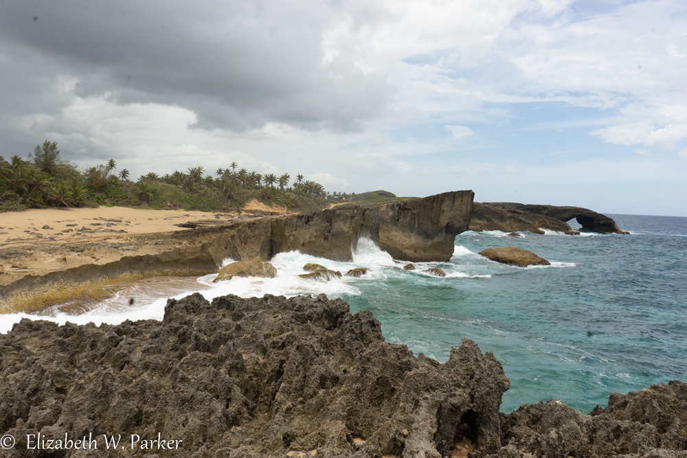
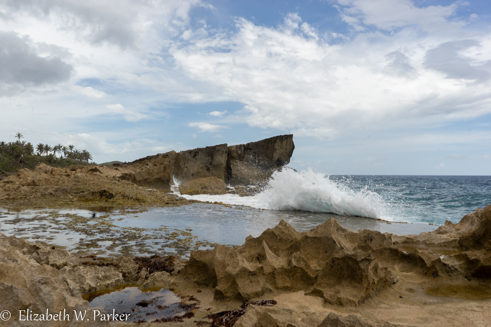
Punta Borinquen Beach is just slightly farther north, and according the to article I linked, encompasses Wilderness Beach, so I guess we found that… There are trails along the beach, and roads for cars that link Punta Borinquen to the Ruins. Now even after looking everything up, I am not sure that Ruins is also a beach, but there are ruins of a lighthouse that was destroyed by an earthquake in 1918. I saw it called “the Old Aguadilla Lighthouse” and also the “Ponderosa Lighthouse.” It is quite a spectacular setting, and not something I have often seen in my 30 years in Puerto Rico.

Moca, a town legendary for its lace-making culture, is not far inland from Aguadilla, so we decided we had seen enough beaches and so set off to find a palacio, a rumored tourist attraction that neither of us had heard of. The palacio turned out to be a palacete, a mansion on extensive grounds outside the city proper of Moca. It is called the Palacete de los Moreau.
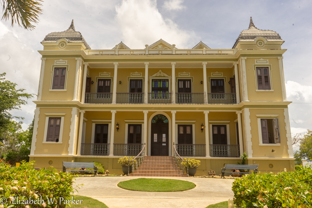
A student of Puerto Rican literature? Then the name will sound familiar! Puerto Rican author, Enrique Laguerre wrote a famous novel called La Llamarada set in this house and based on real people and events. (It has also been made into a movie.) In real life, the family was not named Moreau. The house is named after the fictional family name used in the novel. The writer is buried on the grounds. If you want a tour, check ahead of visiting. The grounds are open, but tours have been affected by Covid restrictions.
And so ended, our two-day jaunt around the north west-of-San-Juan coast and its beaches and sites. You can expect to see similar posts on the other parts of the island.


You must be logged in to post a comment.