Tell the truth! If you were reading a map and saw something prominently labelled “Stone Elephant,” could you resist going to find it?
If you could, you’re not like me (which may be a good thing!). I couldn’t let it rest! After all, when I think of a Stone Elephant now, I think of this one – which I saw in Arches National Park. Yes! I wanted to see another one – one close to home (second home: Wisconsin). So, I planned a trip around it.

Elephants in Arches National Park (June 2015)
Running diagonally through southeastern Wisconsin, southwest to northeast, is the Kettle Moraine State Forest – Northern and Southern Units. The Southern Unit is in my “backyard” being right on my route from Milwaukee to the Farm. Running through the forest and well up into northern Wisconsin is the “Ice Age Trail.” I have wanted to hike it ever since reading “A Walk in the Woods.” It would be my own personal version of hiking the Appalachian Trail.
Kettle Moraine has a ring to it that Wisconsin natives are familiar with, but do you know what it means? Both words are from geology – specifically the geology of glacier action. In this part of Wisconsin, the glaciers dumped loads of sand, rocks and gravel as they receded. The build up of those materials, first picked up by the glaciers then dropped as they receded, is about 300 feet deep (or high). That drift is called a moraine. A kettle is a hole in the moraine formed when a chuck of ice, trapped in the drift, melted. The resulting terrain is alternately rocky, hilly and full of valleys or holes. That’s a kettle moraine in a nutshell.
I stopped about a year ago (Kettle Moraine Hike #1) and hiked a more southern portion, accessible to me right off Highway 12 (part of my standard route back and forth). I remember that the going was rough – a lot of up and down. I remember that the day was quite hot (it was probably August). And mostly I remember that I psyched myself out, a lone woman on a remote trail…and turned around and went back to the car and home.
More recently, I was driving through and picked up a map of the forest, with all the trails (hiking, biking, skiing, snowmobiling, horse) that one might avail herself of for recreation in the forest.

Note: The Stone Elephant! Click on it to see it larger – it is more readable that way.
That’s where I saw the “Stone Elephant.”
So this trip I planned to start from a different point, the “Bald Bluff Scenic Overlook & Natural Area,” find the elephant and then decide what to do with myself – whether to walk back or walk on.
I found a parking lot off County Highway H. I paid the park fee, grabbed my (new) camera and headed off. I was prepared! I was dressed in layers and had a nifty little bag for essentials (like my car keys). There is a little of the Girl Scout still bred into me, so I had tissues in my pocket. Good thing too – on the entire walk I saw no designated “restrooms.”
The walk started out steep, but relatively easy. Quickly it changed to steep and scree! It was a trudge to the top of that climb, but I was rewarded with a bench to rest, and a beautiful view. This must be the Bald Bluff Overlook? The path is pretty well marked, but not so well that I didn’t ask the first two people I met just to make sure I was on it and going the right way. They assured me I was, but they had not reached the elephant so they couldn’t tell me how far it was. No matter – I was going anyway.

And a view to admire.
It wasn’t long before the good old imagination started to kick in and worry me with images of the crime shows I watch on TV and remind me that I was all alone on this path and in the middle of nowhere. I silenced that little bugger by texting a friend where I was, what I was doing and where I had left my car. I imagined that if I turned up missing, she would be able to give the police that info. Strangely enough, as soon as I did that, I stopped thinking about it completely!

Sign may be telling me something…
Let’s get on with the search for the elephant.
It was at least 45 minutes until I found the sign. Fortunately, it was just a skip off the main trail. I smiled when I read the sign, but maybe it was trying to tell me something. Like “You need to be stoned to see the elephant…” I admit I did not see an elephant in this rock. Do you??
Feeling frisky, I decided to continue “up” the path and see where I ended up.

Mostly the path just goes through trees.
The thing about hiking in a forest is the trees. There are lots of trees! You really can’t see much (the forest) for the trees. It also isn’t particularly interesting for a photographer, so I talked to myself most of the way. Boy, did we solve a lot of problems!
There were highlights. I walked past an area where the trees were sparser and a white flower was growing in patches of sunlight. It smelled really good, but I do not know what the flower was or if it was the flower that made everything smell so good. At another stop, I took a couple of panoramas (easy with the new camera), stitched them together and got a good picture of the type of terrain that makes a kettle moraine.

This panorama shows the kettle clearly.
I also walked down an incline into an extensive stand of tall, skinny pines. They were beautiful! All were so straight and so tall. If you have even been to Cathedral Point on Trout Lake – that’s the feeling!
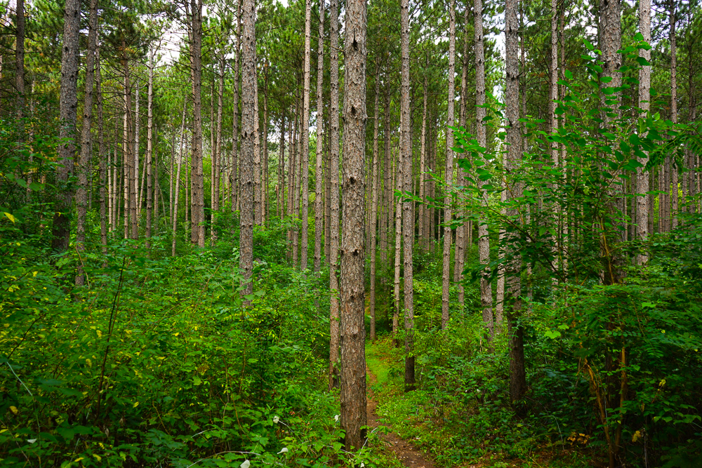
Beautiful stand of very tall, skinny pines.
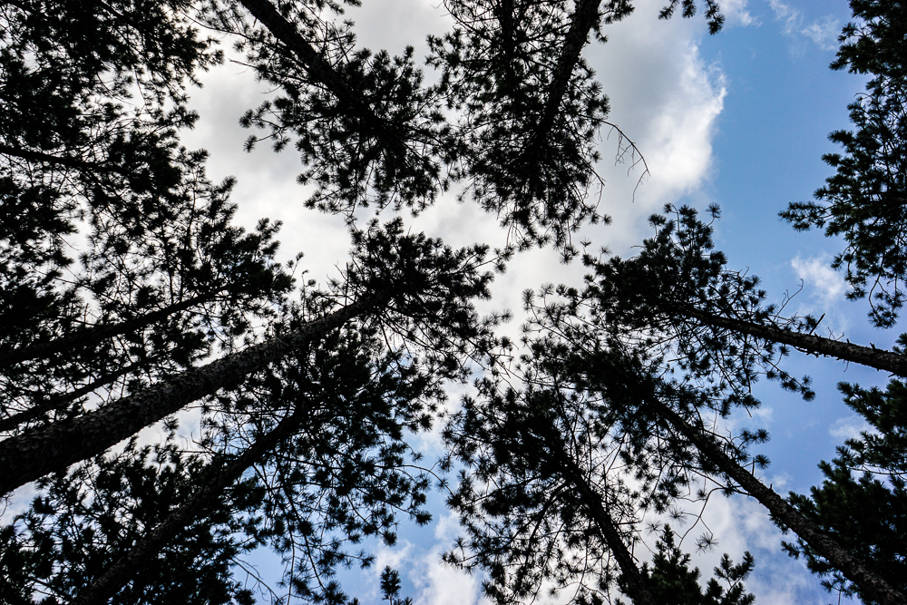
Looking skyward is a treat!
But for the most part, I just talked to myself and many imaginary fellow walkers, friends, who I needed to have discussions with.
I reached Tamarack Road and faced a decision. Would I go back the way I came to return to the car, or would I walk down Tamarack Road to Young Road and then up Highway H to find my car? I remembered my geometry and knew which way was “shorter” (if you don’t take into consideration the ups and downs of the terrain). I opted to go the longer route because at least I would be walking on asphalt and that had to be easier!
It was. My round trip was just over 6 miles.
Thankful as I was to reach my car and sit down, I did make two other sightseeing stops on the way home. You’ll see on the map I posted earlier that there are two other landmarks – the Emerson and Oleson log cabins. I stopped to admire and photograph both. These cabins were built by Norwegian settlers in Wisconsin.
The Kettle Moraine Hike #2 takeaways:
1) Be prepared (See paragraph 8. Hint: tissues.)
2) Go with a friend! Hiking in a forest is much more fun with another human for conversation. Plus you can go in two cars, leaving one at each end, so you aren’t forced to do a loop.
The Kettle Moraine State forest is open year ’round. There are so many ways to enjoy it. You have no excuse.

You must be logged in to post a comment.