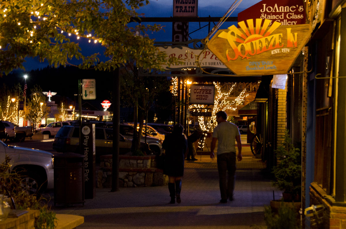
Downtown Truckee at night.
Our visit to Annie and David’s began with a very long day of airline travel. We left San Juan at 6:40am bound for Miami, then Chicago and finally Reno, Nevada, where we arrived at 7:15pm (and a three hour time change). Just getting out into the fresh air after so many hours was wonderful.
But, what fresh air! Clear, crisp and cool- how much of what I perceived was the knowledge that we were in the mountains?
The drive from Reno to Truckee took just a little more than a half hour. The scenery was lovely. I could not get enough of the tall pines, the rocky outcrops, and the clouds scudding across the sky as we wound our way through the valleys travelling southward and upward on I-80. Our only moment of misgiving was created by following the GPS rather than using David’s offer of directions; the GPS sent us down an unpaved and severely rutted road – a short cut (?) to Annie and David’s house.
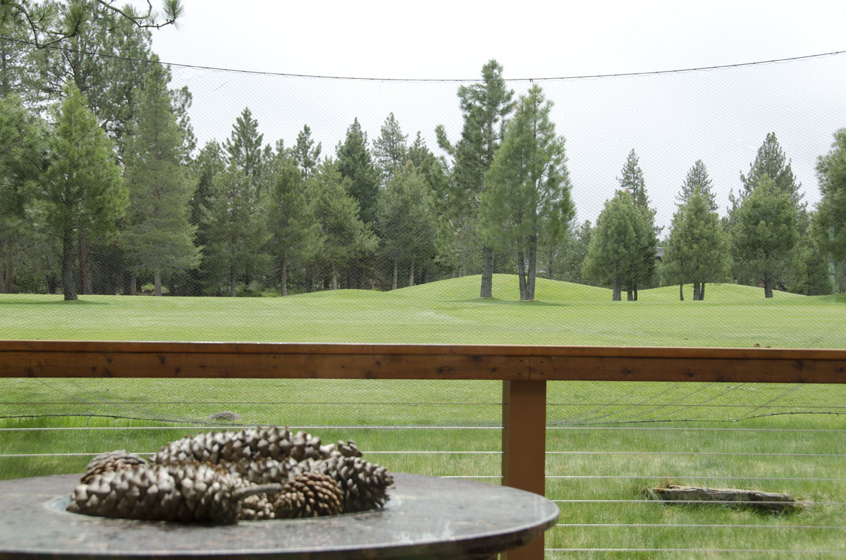
Huge pine cones! (Sugar Pine cones) One of many natural marvels!
It was wonderful to see them again! Our last time together was about 14 months ago when we were all in Death Valley with Raul. Our shared interest in photography insures that this visit, too, will be filled with picture taking and talk about photography.
With a delicious soup made from grocery store roast chicken, fire roasted tomatoes (from a can!), avocado and tortilla strips; margaritas, and lively catch up conversation, our first day came to a late, but satisfying end.
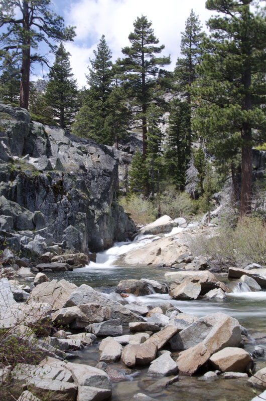
Thursday morning we woke up to rain, but ventured out by car to see and explore the area around Truckee, specifically near Donner Lake. Donner Lake is “Truckee’s lake” – where residents swim and boat and fish. The scenery is stunning. The rain makes all the colors more intense and accentuates the textures of the flora and the rocks. The dark red-brown trunks and delicate, long green needles of the pines define statuesque sentinels in the rain. The aspens glow lime green from their new leaves. The lake is gloomy with dark grey water and ominous, low hanging clouds. It is drizzling. Still the excitement of the cliffs that fall off at the side of the road and the snow be-speckled mountains in the distance are undiminished by the weather. Conditions improve as the morning wears on, and a post-prandial walk reveals drops of moisture still falling despite the sunshine breaking through.
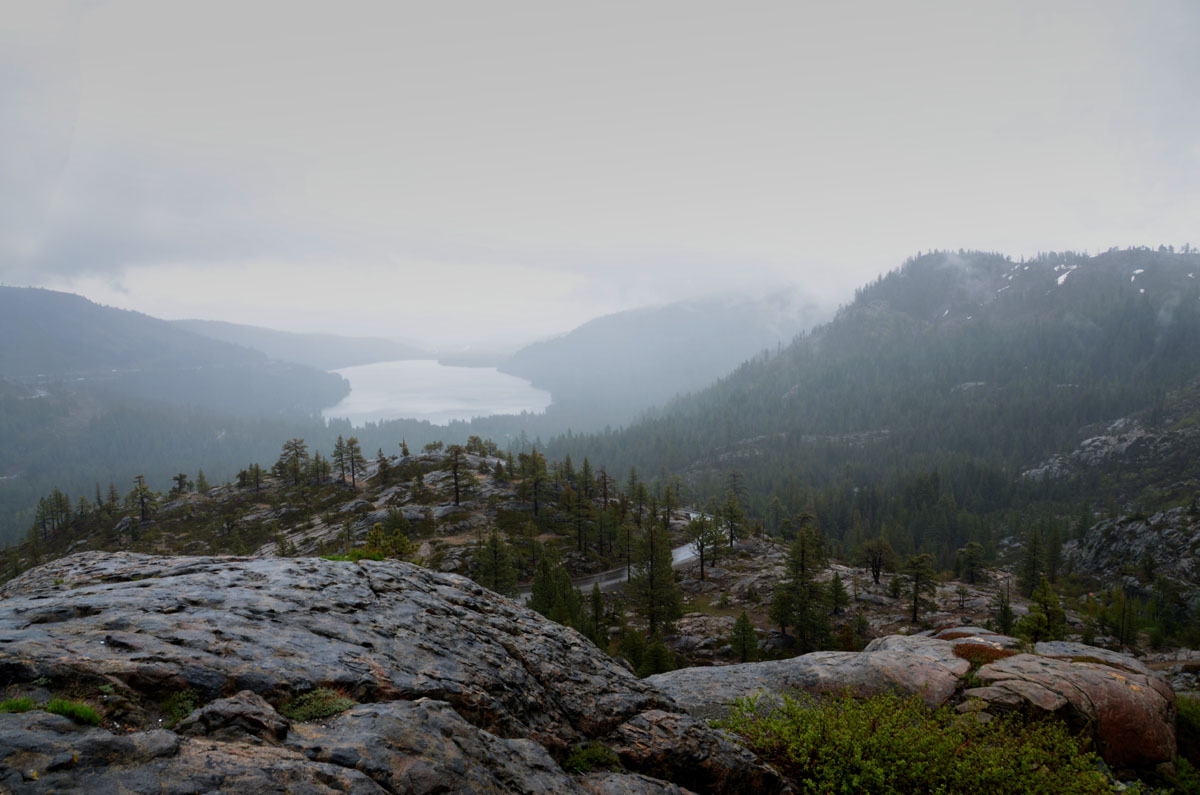
Near Donner Pass (?) looking back at Donner Lake.
The harsh winter climate is much in evidence, even without snow on the ground now. The roofs of the houses are very steeply pitched to facilitate the snow sliding to the ground. Walkways to the front doors are covered and protected – apparently you can count on having to tunnel to your door to get into the house in the winter, when the snow can reach the second floor. On public building we saw signs warning people from standing too close to the roofs overhang…Snow and ice shedding area! Given that many of the roads are also closed in the winter, this is an area mainly for summer residents. Squaw Valley is here: the skiing must be fantastic!
Different stories abound about how the region got the name Truckee, but the most popular ascribes it to a Paiute Indian chief of the Washoe tribe. Chief Truckee guided many parties of white settlers through the passes in the mountains, and even was named a ‘captain” of the Us Army for his participation in the war with Mexico over Texas.
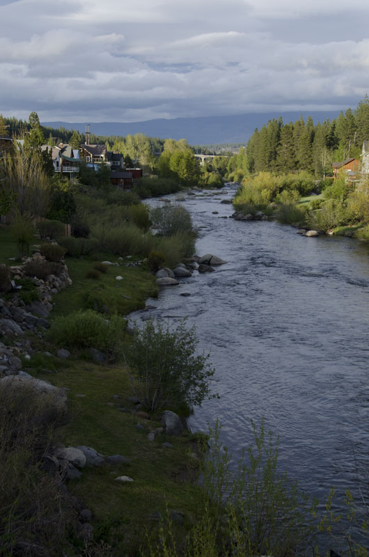
The Truckee River runs through town.
This area also has a tragic tale, the story of the Donner party, a group of some 40+ people who got trapped by snow in these mountains. About half the party, and most of the men, died. There is talk of cannibalism in the stories, too.
Truckee has a happier history, too. One visionary civic leader, C.F. McGlashan, almost single-handedly built up the tourism industry in the area. You see there was huge railroad traffic through Truckee. It was an important way station for the trains crossing the Sierras going to and fro between the Midwest and California. McGlashan wanted people to stop in Truckee, rather than just look at it out the window of the passing train. He promoted a “rocking stone” as a tourist attraction and built up a winter sports industry with games of skiing, skating, sledding, etc. He built ice sculptures and even ice palaces! It worked!
A lazy afternoon of camera tweaking, looking at pictures, and planning the week kept Annie, David and me occupied while Gerry napped.
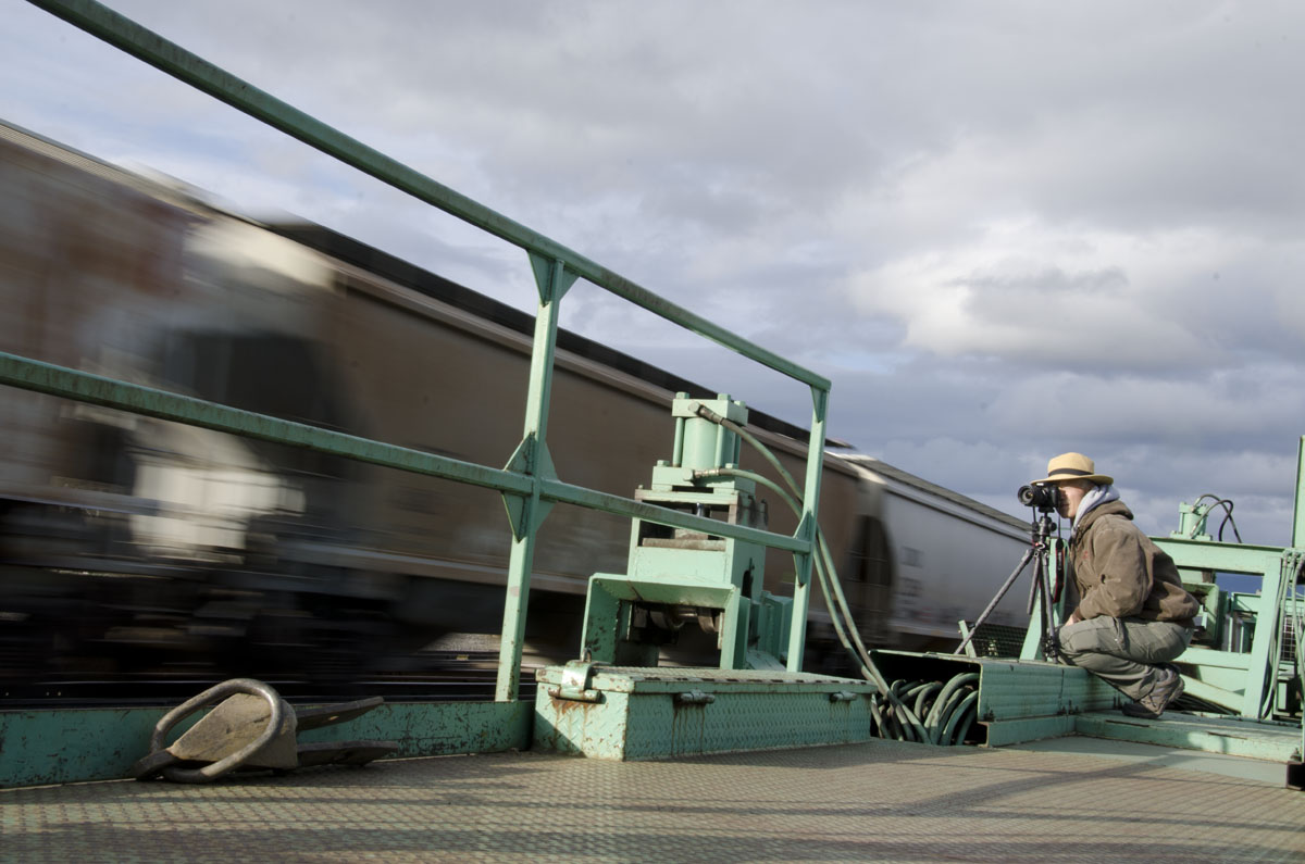
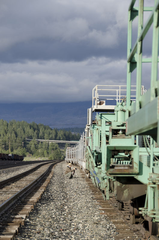
The railroad is still very active. Three trains went by while we were shooting.
By evening, the weather was dry, with some spectacular clouds highlighted by the low angle of the sun. We headed into the town of Truckee to take pictures around the railroad yards. While we waited for the blue hour, killing time in a bar seemed like a good idea! (It was a way to warm up, too.) Fortified by drink, we ventured back outside. The lights of the town were on and we got some decent shooting in before we headed home for a late, but good-n-hot dinner and a glass of wine.
I loved the color of this train!
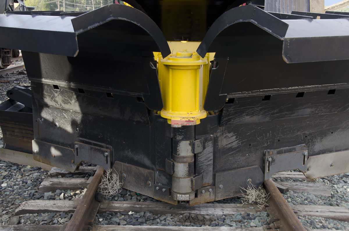
Train with a snow plow attached.
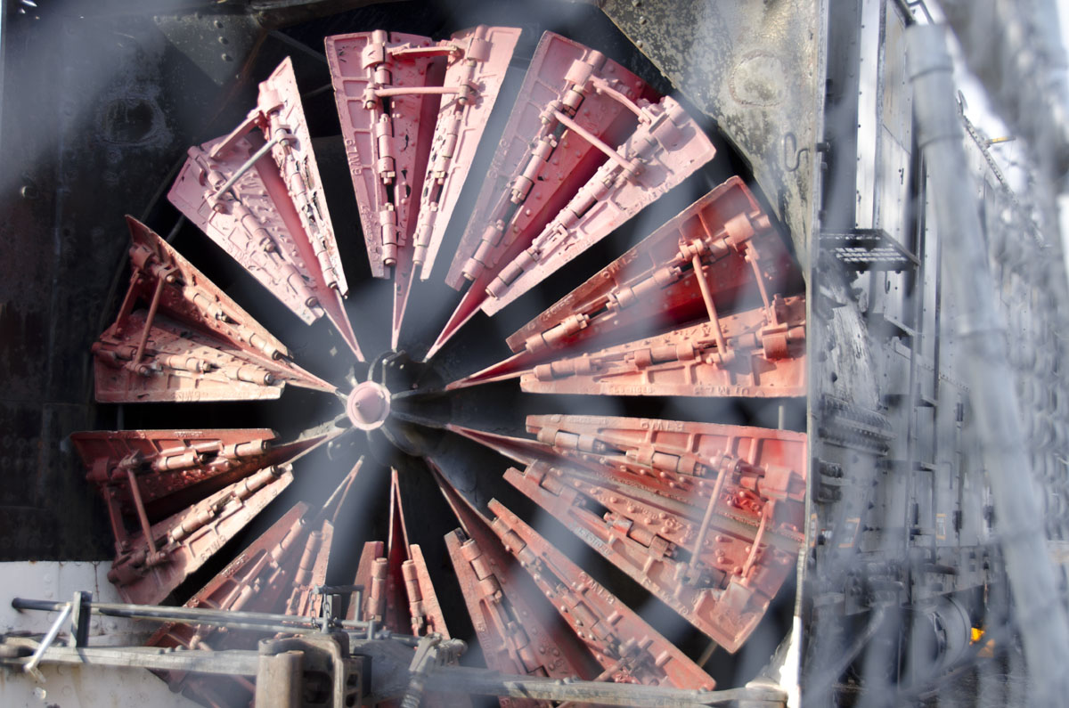
This is a train car with a snow blower!
Funny expression. Must mean something specific when talking about trains.
Friday, we were wheels up mid-morning on our way to see the western side of Lake Tahoe. (If you click on the link to see the map, scroll down to the second map, West shore Hiking (particularly the inset), to see the area I am going to describe below.)
You will have to forgive my gushing superlatives because this is my first time in this area. It is world famous for very good reason. As I looked around it was one gasp after another. How many times did I say “How beautiful!”?
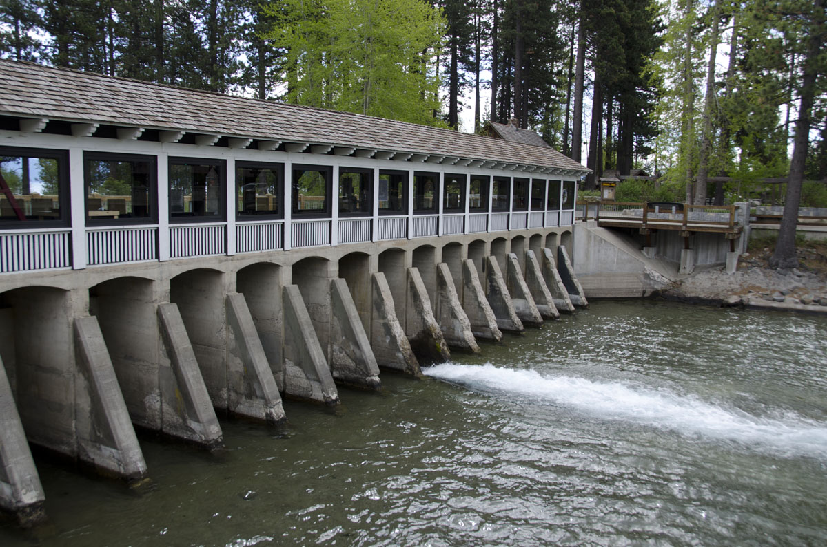
This is the Dam that controls the water leaving the lake. There are BIG fish in the shallows waiting for dinner.
Our first stop was the dam that controls the water in the lake. There is a cute little café there, where we got coffee. The dam is old, and there are some informative exhibits along it about the amount of water in the lake, and the lake levels over time. Since 1917, water is being removed from the lake for cities farther west down the mountains.
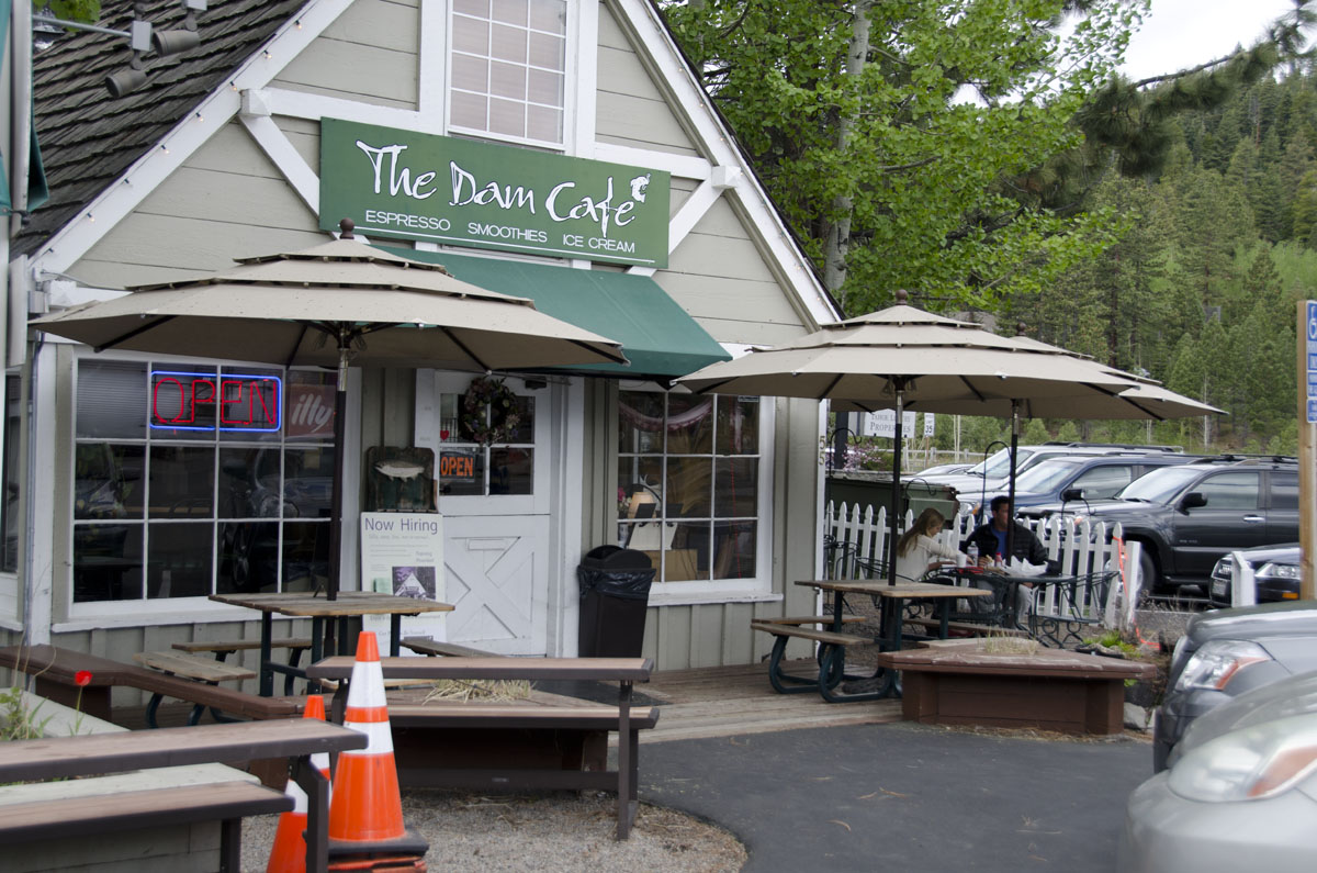
Famous spot! We had coffee.
Next we stopped at a place called Eagle Falls that overlooks Emerald Bay. The falls were rapid, rushing, raging over the rocks as they crashed down the steep slope. Their noise was a stark contrast to the serene waters of the lake far below us, just twinkling in the sunshine.
From the falls, we turned away from the lake and began to hike upwards, heading for an area known as the Desolation Wilderness. Annie marveled at how early the spring had arrived this year and worried at what an early, and dry, spring bodes for the summer. A good portion of the way we walked is usually still blocked by snow at this time of year.
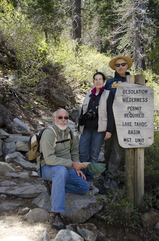
David, Annie and Gerry
I took this standing on a bridge. It was such fun to watch the water come down the little falls we encountered along the way.
We walked for several hours, stopping often for picture taking, and to step off the path to admire the scenery and let faster hikers pass, in both directions.
Desolation was not a fitting term for what I could see. Around us, the sun danced through the leaves of the trees overhead, brooks raced between boulders tumbling joyously under the bridges we crossed. Crooked, gnarled old pines clung tenaciously to enormous rounded boulders and jagged outcrops. And always, in the distance, at every horizon, we had the intense, super-natural blue of Lake Tahoe.
Along the way, we stopped to talk with other hikers, many foreigners, older people as well as younger, with kids, with dogs. There was a lot of activity on the mountain for a Friday!
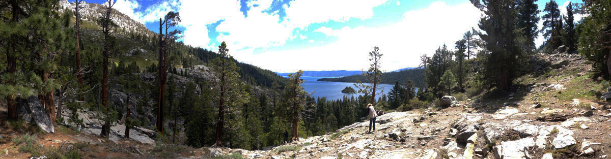
Please ignore the strange blue in the sky – The lake was literally that blue!
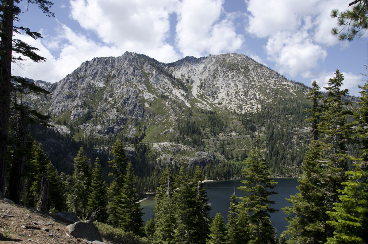
Quintessential view of Lake Tahoe and the mountains
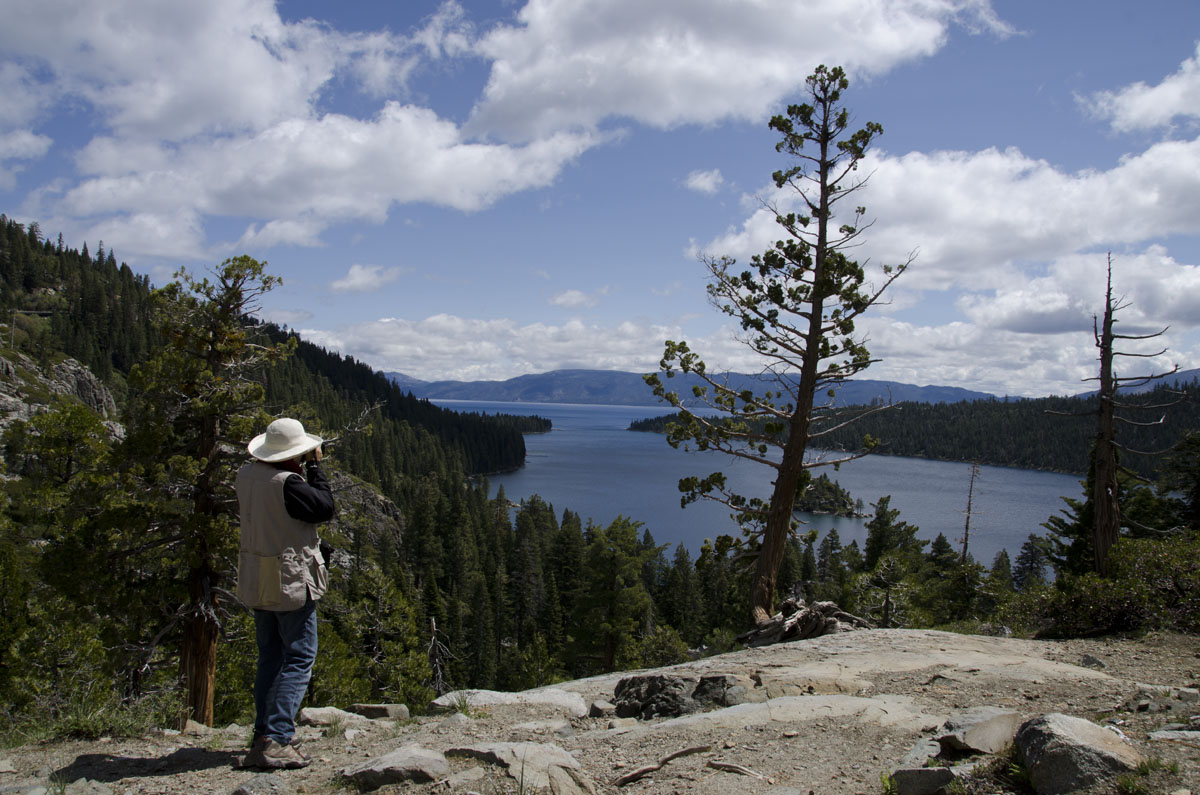
Annie shooting the lake.
We did not make it all the way to Desolation. When we finally turned around to head back down, we were supposedly just 15 minutes from the top. (This was according to some 20 somethings who can cover a lot more ground in 15 minutes than we can!) Besides, we also have plans for the evening – a dinner party! Great company, great food, (too) much wine and a long discussion about art! So ended another fantastic day.
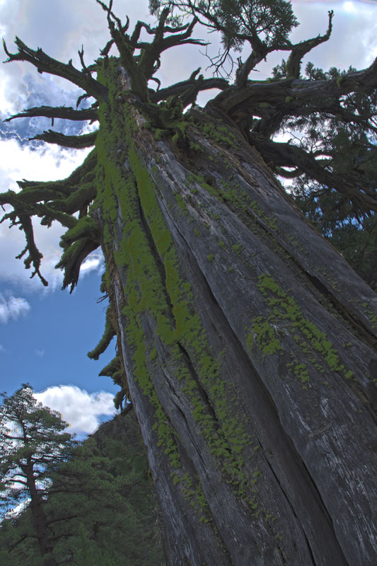
The moss on the trees was so interesting, thick and bushy.
Snow flower. (Really cool!)
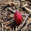
A stream along our Desolation Wilderness hike.
Road trip! We were up early Saturday morning to drive south to Mono (moh-noh) Lake. It is about 3 1/2 hours away, but en route we will visit the eastern (Nevada) side of Lake Tahoe.
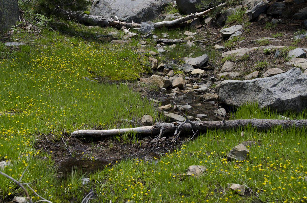
The overlook where we stopped has a beautiful view of the lake, but we also picked up the trail that leads down to a shore spectacularly littered with enormous boulders. I was amazed to learn that just off the shore where we were standing there is a sunken forest – the tree stumps are so big that scientists speculate the trees were well over 300 years old before they were drowned by the rising water of the lake! Also noteworthy is the clarity of the water. According to my reading, the lake is losing about a foot of clarity every decade. Even so, it is still crystal clear to about 70 feet. Clarity is a casualty of human activity in the area – pollution from cars, agricultural run-off, pesticides, fertilizer, sewage. Nothing new in that list.
Huge boulders on the Nevada side of Lake Tahoe
The Nevada side of the lake is an interesting juxtaposition of fancy houses and old-fashioned little towns, replete with the requisite tacky casinos.
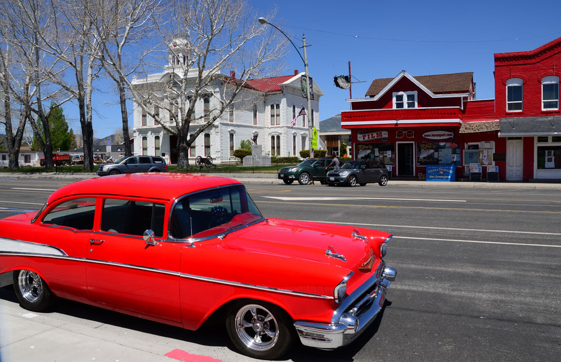
We stopped in one of those towns for lunch: Our first scene included a beautifully maintained red and white Chevrolet Bel Air parked in front of an Indian crafts store, and an old white Victorian city hall across the street. Definitely picturesque (so I took pictures!)
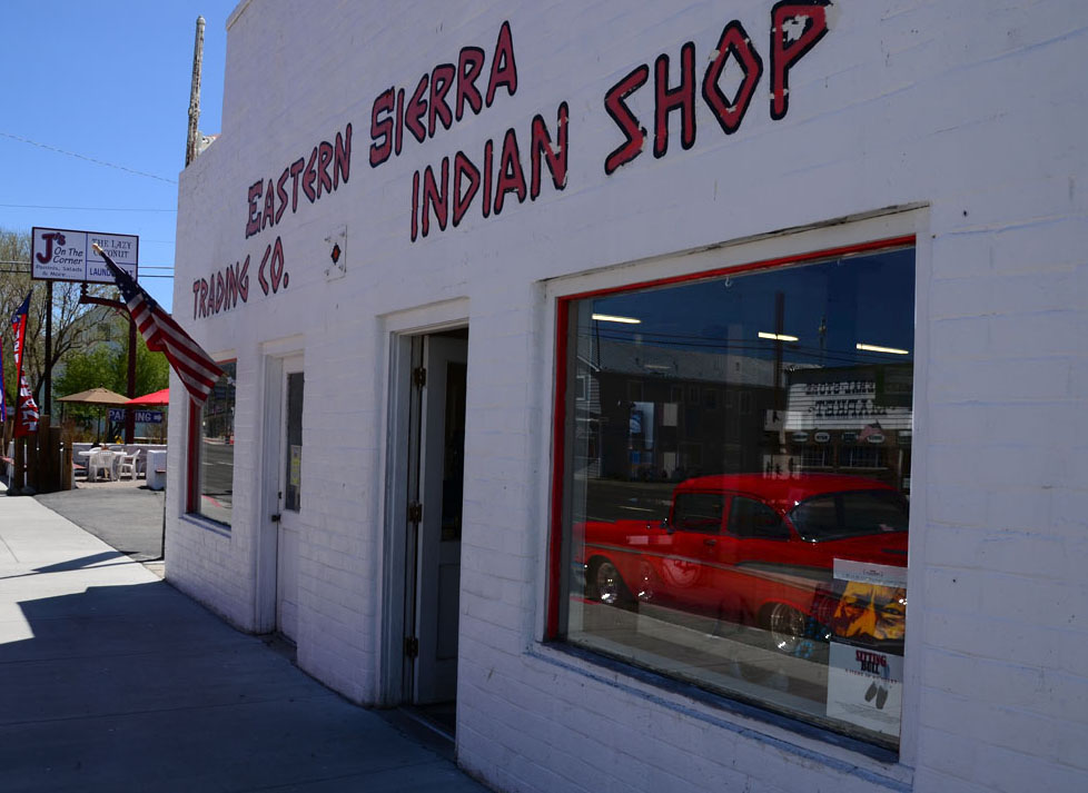
Belaire in Bridgeport
Bridgeport City Hall
Just down the road was the turn off for the Bodie State Historic Park. A ghost town!
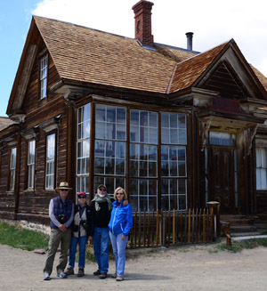
Our daily group shot.
With fingers crossed, legs crossed and even eyes crossed, I was hoping we were going to detour to see it. Yes! We all agree it is worth the detour (that was while the road was still paved!). Once we were down to 10 miles per hour on a hugely rutted gravel road, we were having second thoughts. At the first glimpse of the ramshackle remains stretched across the scraggly plain, we knew we had made the right decision!
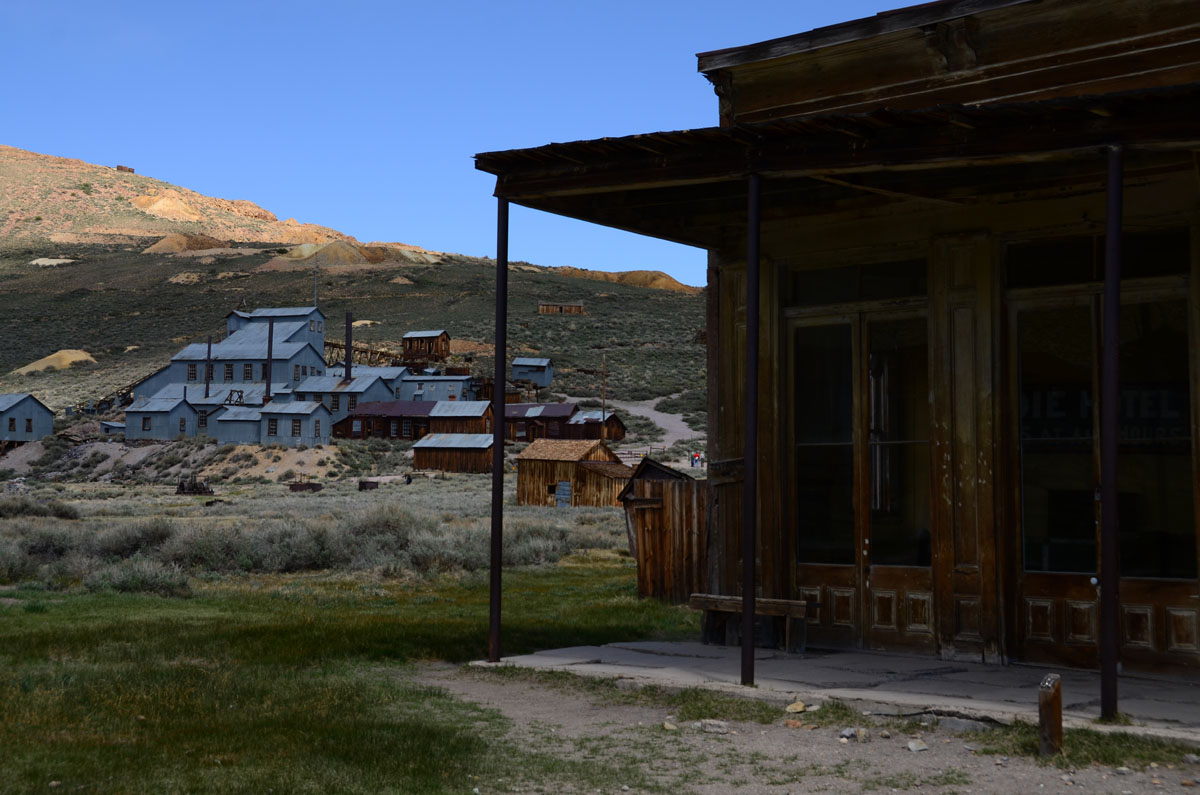
Looking up towards the mine – That was the reason for this town. When the mine was depleted, the town was abandoned..
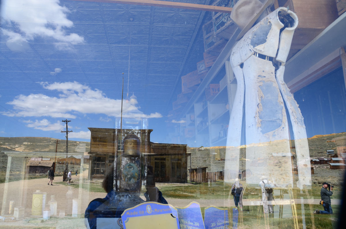
The place was full of tourists, and lots of cameras, so we fit right in. The town had quite a colorful history and a rather unsavory reputation. Today, what remains are the ghosts – you glimpse them in the broken and half buried cars left to rust in the grass, in the ragged mannequins still visible in the store windows, in old lamps and carriages, abandoned tools and furniture, curtains held together by fragile cobwebs. Yet the town still exudes a pioneer spirit, a rugged sense of perseverance, the expectancy of an unfinished story.
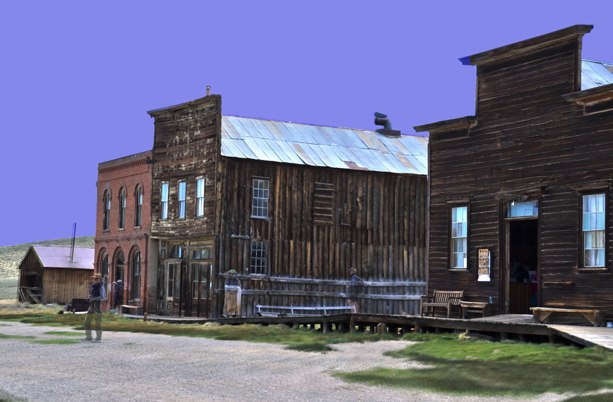
This is a composite picture. I like it because the people appear ethereal – a little like the ghosts one would expect to sense in this town. How many can you count? I think there are 5-6.
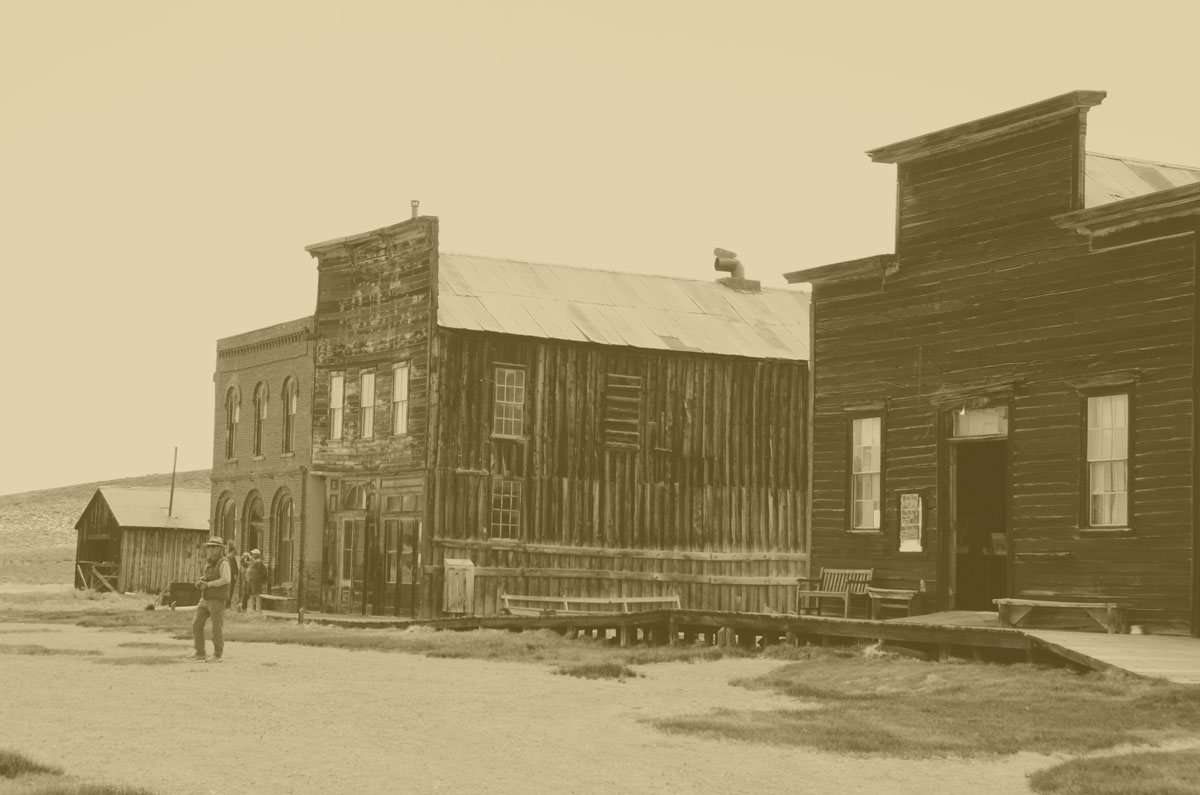
Another “ghostly” image?
We would have stayed longer (If you go, plan for at least half a day) but even greater things awaited us ahead.
To continue reading this journal, click here.
The sepia treatment seemed really appropriate for this picture of David.

Betsy, This was fun to read, a great reminder of our days spent together. Your so good at this…Love it!
Thanks! It was fun! There is more coming-today I hope! And some pictures I forgot.